SUMIF: The Digital Intelligence Framework Transforming Methane Monitoring in Oil & Gas By Prasad Selvaraj https://dig-ahead-44653197.figma.site/login (Username: demo, Password: demo) Methane is one of the most potent greenhouse gases, with a warming potential more than 80 times greater than carbon dioxide over a 20-year period. The oil and gas industry faces immense pressure to detect, measure, and mitigate methane emissions in line with the UN-backed OGMP 2.0 Gold Standard. However, traditional monitoring systems remain fragmented, reactive, and inefficient. To address this gap, I developed the SAT–UAV Methane Intelligence Framework (SUMIF) — a unified, AI-powered digital ecosystem that integrates satellite data, UAV-based sensing, and mass-balance modeling to deliver continuous, verifiable, and auditable methane intelligence across offshore, production, and refinery assets. 🚀 What is SUMIF? SUMIF is a multi-layered methane monitoring architecture that combines:...
Get link
Facebook
X
Pinterest
Email
Other Apps
Role of Drones in Methane Emission Detection and Mitigation
Get link
Facebook
X
Pinterest
Email
Other Apps
-
Role of Drones in Methane Emission Detection and Mitigation
By Prasad Selvaraj – The Digital Oilfield
Abstract
Methane is one of the most potent greenhouse gases, and reducing its emissions is critical in the fight against climate change.
Drones have emerged as a powerful tool for detecting, quantifying, and monitoring methane emissions across oil and gas,
landfills, agriculture, and other sectors. When combined with advanced sensors and artificial intelligence (AI), unmanned
aerial vehicles (UAVs) provide high-resolution, real-time data that enables faster leak detection, better mitigation strategies,
and more accurate emission inventories. This article reviews methane emission sources, explains how drone technology
enhances monitoring, and outlines benefits, limitations, and best practices for drone-based methane mitigation.
Figure 1 – Natural and anthropogenic methane sources.
1. Why Methane Emissions Matter
Methane (CH4) is a powerful greenhouse gas with a warming effect many times higher than carbon dioxide over a
100-year period. Even relatively small leaks can have a strong climate impact, which makes early detection and accurate
measurement essential for effective mitigation.
1.1 Natural vs. Anthropogenic Sources
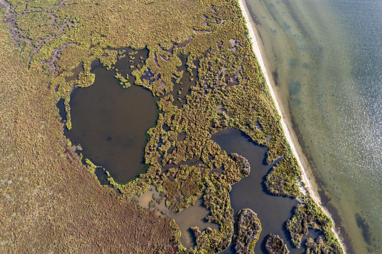
Natural sources include wetlands, termites, and certain water bodies where biochemical reactions release methane into the atmosphere.
Anthropogenic (human-caused) sources include:
Oil and gas operations (production, processing, transmission, storage)
Agriculture (livestock, manure, rice paddies)
Landfills and waste management
Each source behaves differently, so one-size-fits-all solutions do not work. Instead, we need targeted monitoring strategies
and technologies that can adapt to different environments and emission patterns.
Figure 2 – Climate impact of methane compared to CO2.
2. From Military Tool to Climate Ally: Introduction to Drone Technology
Drones, or unmanned aerial vehicles (UAVs), were originally developed for military reconnaissance and combat. Today,
they play a growing role in environmental monitoring and climate action. Equipped with advanced sensors and onboard
processing, drones can detect methane leaks at scales and resolutions that are difficult or impossible to achieve with
traditional ground-based or satellite-only methods.
2.1 Why Drones Are Well-Suited for Methane Monitoring
Reach – Can access remote, dangerous, or hard-to-reach locations such as offshore platforms, large landfills, or rugged agricultural fields.
Resolution – Fly close to the source, capturing detailed concentrations and plume structures.
Efficiency – Cover large areas faster than ground crews, with repeatable flight paths.
Clean Operation – Battery or fuel cell powered drones produce no direct emissions at point of use and operate with relatively low noise.
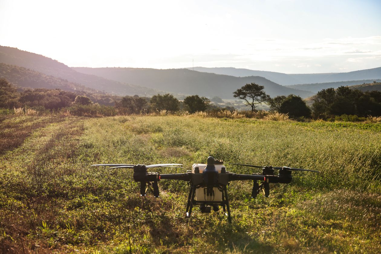
Figure 3 – Example of a methane-detection UAV platform.
3. Drone-Based Methane Detection Techniques
Several advanced sensing techniques turn drones into powerful methane detectors. By mounting specialised instruments on
UAVs, operators can visualise, quantify, and track methane emissions in real time.
3.1 Airborne Spectroscopy
Spectroscopy-based methods analyse how methane absorbs specific wavelengths of light. Airborne or drone-mounted
spectrometers scan the atmosphere and compute methane concentrations along the flight path. These systems can:
Detect methane plumes from industrial facilities and landfills.
Estimate emission rates using concentration and wind data.
Provide wide-area coverage with precise quantification.
3.2 Thermal Imaging & Optical Gas Imaging (OGI)
Optical gas imaging cameras use infrared (IR) technology to make invisible gas plumes visible as a moving “cloud” in
the video feed. When mounted on drones, OGI:
Quickly reveals leaks at valves, flanges, tanks, and pipelines.
Is especially effective for larger leaks or persistent venting.
Gives operators an intuitive visual overlay for locating and fixing leaks.
Figure 4 – Thermal / OGI visualisation of methane emissions.
3.3 Real-Time Data Collection and Processing
Highly instrumented drones can stream methane readings, GPS coordinates, and wind data in real time to ground stations.
This supports:
Immediate identification of leaks and hotspots.
Dynamic adjustment of flight paths to follow plumes.
Faster reporting and decision-making for repair teams.
4. Methane Detection in Different Sectors
4.1 Oil and Gas Operations
In the oil and gas sector, drones equipped with sensors such as the laser falcon methane detector are widely used to
monitor production facilities, pipelines, and storage sites. They support:
Routine inspections of well pads, compressor stations, and tank farms.
Close-range detection of leaks in equipment and piping.
Benchmarking of emissions to track reduction progress over time.
Figure 5 – UAV methane inspection over oil and gas infrastructure.
4.2 Landfills
Landfills are major methane sources due to decomposing organic waste. Drone-based methane monitoring has significantly
improved how operators detect and manage landfill gas:
Fast coverage of large, uneven landfill surfaces.
Improved safety by reducing the need for inspectors to walk on unstable terrain.
Detailed gas maps that support compliance with environmental regulations and optimise gas capture systems.
Figure 6 – Drone-based methane survey over a landfill.
4.3 Agriculture
Agriculture contributes significantly to methane emissions, especially from livestock and rice production. Drones enable:
Mapping methane concentrations over fields, barns, and lagoons.
Combining gas data with wind and terrain models for fine-scale analysis.
Testing the impact of different farming practices or feed strategies on methane output.
Small UAV systems can produce high-resolution methane and wind maps, helping farmers and researchers design targeted
mitigation strategies.
Figure 7 – Agricultural methane monitoring with drones.
5. Impact on Methane Mitigation Strategies
5.1 Transforming Leak Detection and Repair (LDAR)
Traditional LDAR programmes rely on manual inspections and handheld instruments. Drones change this by:
Finding leaks faster and more comprehensively than ground-only surveys.
Reaching elevated or confined areas without scaffolding or rope access.
Reducing overall inspection time, labour, and cost.
This increases the effectiveness of leak detection and repair programmes, directly contributing to emissions reduction.
5.2 Regulatory Compliance and Environmental Reporting
Drones help companies meet strict environmental regulations by:
Providing auditable, geo-referenced records of inspections and leak repairs.
Supporting compliance with methane emission standards and monitoring rules.
Enabling more frequent and detailed reporting to regulators and stakeholders.
5.3 More Accurate Methane Inventories
Conventional emission inventories often rely on generic emission factors and limited measurements. Drone-based surveys:
Capture actual field data rather than estimates.
Detect both large and small leaks with laser-based technologies.
Improve the accuracy of company- and sector-level methane inventories.
6. Future Directions and Challenges
6.1 AI-Enabled Drone Operations
Integrating artificial intelligence into drone workflows is a major next step. AI can:
Automatically analyse methane and imagery data to identify leak patterns.
Predict high-risk locations based on historical trends and conditions.
Optimise flight paths for maximum coverage and detection probability.
Figure 8 – AI-driven analytics on drone methane data.
6.2 Legal and Ethical Considerations
Widespread deployment of drones raises important questions:
Privacy and Data Protection – Overflights may capture imagery of private property or individuals.
Regulatory Differences – Rules for UAV operations vary by country and region, affecting flight permissions and data use.
Community Acceptance – Noise, visual presence, and misunderstanding of drone activities can create public concern.
Clear guidelines, transparent communication, and responsible data policies are essential for long-term acceptance.
6.3 Global Role in Methane Reduction
Because drones are scalable and adaptable, they can be deployed in:
Remote natural gas fields and production basins.
Urban infrastructure, landfills, and industrial clusters.
Agricultural regions across different climates.
With proper governance, drones can become a central tool in global methane mitigation efforts.
7. Benefits, Limitations, and Practical Solutions
7.1 Key Benefits of Using Drones for Methane Monitoring
Enhanced Detection – High precision, including small leaks in difficult locations.
Cost-Effective – Reduced need for manned aircraft and extensive ground patrols.
Real-Time Insights – Immediate data streams enabling fast response.
Improved Safety – Keeps human inspectors out of hazardous zones.
7.2 Major Limitations
Regulatory & Privacy Constraints – Restricted airspace and privacy laws can limit where and how drones are flown.
Technical Boundaries – Limited flight time (battery), payload capacity, and vulnerability to harsh weather.
Data Complexity – Large volumes of data require advanced processing, which can delay action if not well managed.
7.3 Addressing the Limitations
Regulatory Collaboration – Working with civil aviation and environmental agencies to clarify rules and streamline permissions.
Technology Improvements – Investing in better batteries, more robust airframes, and resilient sensors.
Integrated Monitoring – Combining drones with satellites and ground-based sensors to create a more complete picture.
Aspect
Benefits
Limitations
Possible Solutions
Operations
Fast coverage, hard-to-reach areas
Flight time, weather dependence
Battery R&D, robust designs
Regulation
Approved tools for environmental monitoring
Airspace, privacy restrictions
Policy engagement, clear guidelines
Data & Analytics
High-resolution, real-time insights
Data overload, processing complexity
AI/ML analytics, smarter pipelines
8. Tips and Best Practices for Drone-Based Methane Monitoring
8.1 Use Advanced Sensors
Employ technologies such as tunable diode laser absorption spectroscopy (TDLAS), infrared cameras, and specialised gas
detectors to achieve accurate, sensitive measurements.
8.2 Establish Regular Monitoring Schedules
Define routine flight schedules over high-risk areas (oil and gas assets, landfills, agricultural facilities) to catch leaks early
and track trends over time.
8.3 Integrate Data Analytics and Machine Learning
Combine drone data with machine learning models to detect patterns, predict leak locations, and support proactive mitigation
rather than reactive fixes.
8.4 Collaborate with Environmental and Regulatory Agencies
Partnerships with environmental agencies and regulators help align drone programmes with best practices, provide access to
shared data, and enhance the credibility of reporting.
8.5 Prioritise Safety and Ethics
Respect no-fly zones, privacy rules, wildlife sensitivity, and community concerns. Clear communication about the environmental
benefits of drone monitoring can build trust and public support.
9. Conclusion
Drone technology has become a game-changer in methane emission detection and mitigation. With real-time, high-resolution
data and growing AI integration, drones are more effective than traditional methods at identifying leaks, supporting regulatory
compliance, and improving emission inventories. At the same time, legal, technical, and ethical considerations must be
carefully managed to ensure responsible deployment.
As global attention turns to rapid methane reduction as a climate priority, drones offer a practical, scalable, and powerful
solution. When combined with robust analytics and thoughtful governance, they can significantly accelerate progress toward
a low-emission, climate-resilient future.
SUMIF: The Digital Intelligence Framework Transforming Methane Monitoring in Oil & Gas By Prasad Selvaraj https://dig-ahead-44653197.figma.site/login (Username: demo, Password: demo) Methane is one of the most potent greenhouse gases, with a warming potential more than 80 times greater than carbon dioxide over a 20-year period. The oil and gas industry faces immense pressure to detect, measure, and mitigate methane emissions in line with the UN-backed OGMP 2.0 Gold Standard. However, traditional monitoring systems remain fragmented, reactive, and inefficient. To address this gap, I developed the SAT–UAV Methane Intelligence Framework (SUMIF) — a unified, AI-powered digital ecosystem that integrates satellite data, UAV-based sensing, and mass-balance modeling to deliver continuous, verifiable, and auditable methane intelligence across offshore, production, and refinery assets. 🚀 What is SUMIF? SUMIF is a multi-layered methane monitoring architecture that combines:...
The Digital Oilfield · Field Note Chevron, ExxonMobil and a wave of gas turbines are turning the American oil patch into the power supply for artificial intelligence — and rewriting what an energy company is. By Prasad Selvaraj · September 8, 2026 The turbines arrived in West Texas the way the drilling rigs once did: on flatbed trailers, in convoys, trailing dust across a landscape that has spent a century learning to absorb the machinery of energy booms. But the crews bolting them into place near Midland were not chasing oil. They were building an electricity plant so large, and so single-minded in its purpose, that it has no customers at all except a server farm — and no real precedent in the hundred-odd years since the Permian Basin was first punctured for crude. This is Project Kilby, a 2.67-gigawatt gas-fired power complex that Chevron and Microsoft agreed this summer to build under a 20-year, roughly $7 billion contract. It will n...
Arctic Circle Oil & Gas Resources, Economic Potential, and Shipping Routes: A Multi-Country Assessment Research Article Prepared by: Prasad Selvaraj Ph.D. Researcher, AI & Deep Learning | Senior Aeronautical Analyst, Qatar Airways, Doha, Qatar 📧 prasad2t@gmail.com 2025 • Arctic Energy, Shipping Routes, Investor Strategy, Climate Transition Risk Abstract. The Arctic Circle contains some of the world’s largest remaining undiscovered conventional oil and gas resources. Melting sea ice is increasing access to these resources and opening new maritime shipping routes such as the Northern Sea Route (NSR), the Northwest Passage (NWP), and the Transpolar Sea Route (TSR). This article reviews the scale and distribution of Arctic hydrocarbons, evaluates the profitability and annual revenue...



Comments
Post a Comment